


Hi, TI team,
I'm running the Area Scanner toolbox with my AWR6843AoPEVM, and trying to extract the point cloud data according to the TLV format describe in "68xx Area Scanner Lab User's Guide".
But after coding and successfully extract all dynamic, static objects' point cloud in each frame, I found that those can not coincide to the position shown on GUI, following figures are my programmed codes and the results:
Matlab codes:

Results for comparison:
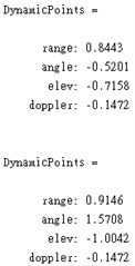
(My results:)

(GUI:)

I find that for static objects, x value is the same, but y, and z are not! I'm not sure that if my programmed codes are wrong or this extracted data still need to convert to be the correct X, Y, Z on GUI?
And similar to the dynamic objects, the point's position is given in spherical coordinates, how to convert to final X, Y, Z?
I'm looking forward for your guidance.
Thank you.
Shihyu.

