


I checked the documentation corresponding to aoaproc. Which uses azimuth and elevation FFTs in both directions to calculate the elevation and azimuth. It is shown below:
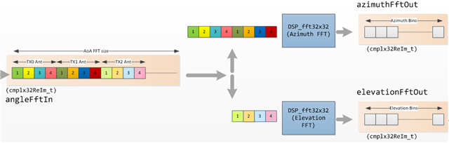
The source code process for aoaproc is the same as the image.
The documentation seems to use the 6843ISK radar as an example. So the 6843 ODS angle estimate antenna was chosen the same way? If not, is there a corresponding source code to refer to?
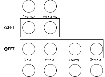
If the idea above is modeled, does the ODS perspective estimate look like the following:
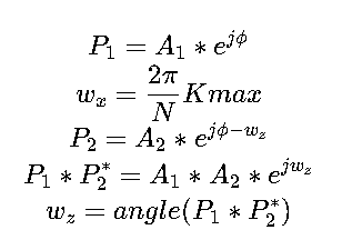
The following formulas are similar to those in the aoaproc documentation:
To summarize, I'd like to know how the radar angle estimation is done, and if I can find the corresponding code?
