


Hello TI team,
Following the signal processing chain of 3D People Counting Demo, I have finished doing CFAR on Range Azimuth Heatmap on PC. But I occur a problem when I try to get the elevations of points. My method is: find range info of detected object data after CFAR, and find the same range in Range Elevation Heatmap, and choose the one with the largest value as the final elevation of points. And this is the result where multiple points form a straight line:
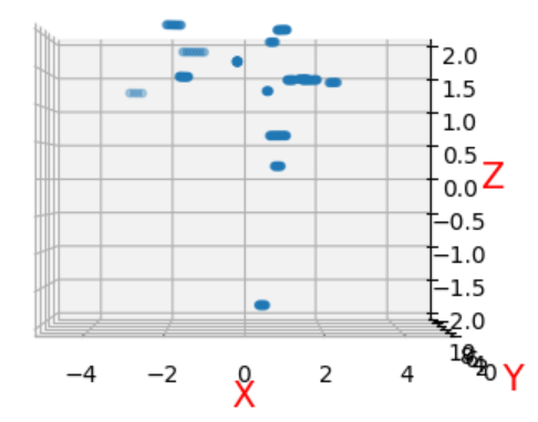
So what is the correct method to get the elevations of points after doing CFAR on range azimuth heatmap? Can you provide related material or python code?
Best regards
Dina
