Other Parts Discussed in Thread: AWR2243,
Tool/software:
Dear E2E Team,
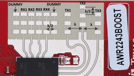
We are currently testing the AWR2243 device using the mmWaveLink_SFlash_FW_Example. Based on its default configuration, it uses two enabled transmitting antennas (txEnable = 1 and txEnable = 2) to collect 8 columns of data, which are then used to generate the Range-Azimuth map.
We have modified both the related C code (firmware) and the mmwaveConfiguration file to enable the third transmitting antenna (txEnable = 4), allowing us to collect additional data for generating a Range-Elevation map as well.
In this case, we now have 12 columns of data. However, I would like to clarify:
- Which 8 columns among the 12 correspond to the Range-Azimuth map?
- And which columns should be used for generating the Range-Elevation map?
Thank you in advance for your assistance.