This thread has been locked.

If you have a related question, please click the "Ask a related question" button in the top right corner. The newly created question will be automatically linked to this question.

CCS/IWR6843: Area scanner-point cloud height

Part Number: IWR6843

Tool/software: Code Composer Studio

Hi ,

Regarding the area scanner.

How can I tell from the 3d data what are the coordinates values of the point clouds.

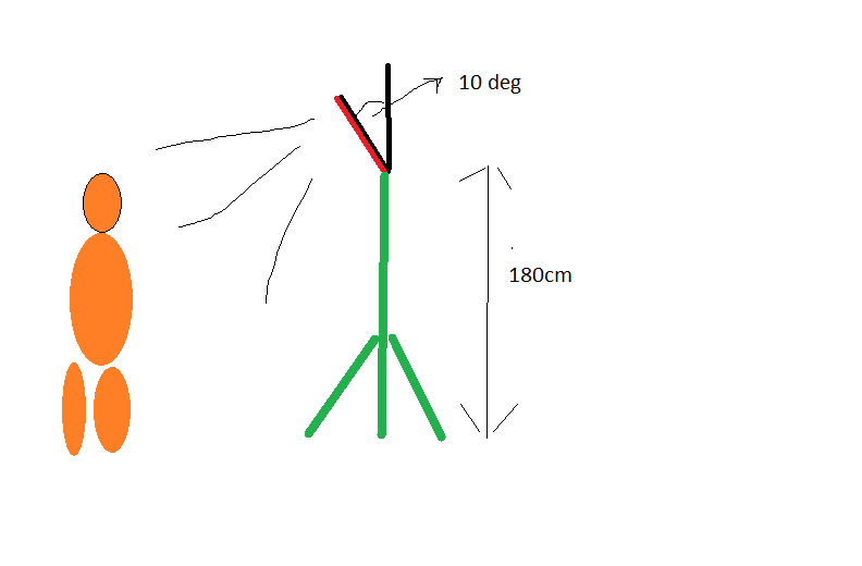
I've mounted the EVM on 1.8[m] tripod, tilted downwards with 10 degrees (as appears in the documents)real world coordinates:

evm @ x=0 y=0 z=1.8

myself @ x=0 y=3[m] z=1.8(top of the head)

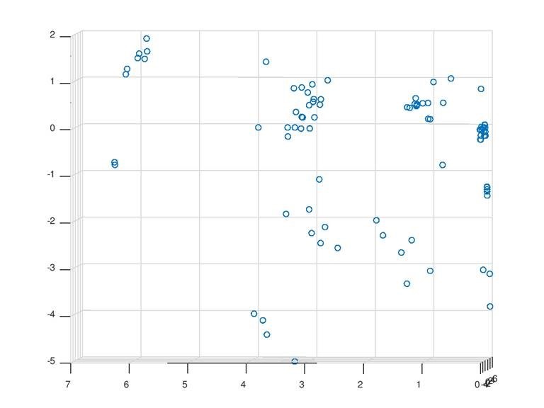
When recording my self on the scene  I get the attached readout.

Column 2,3 4 are x,y,z.

Therefore when examining the data I see that the z values lay between -5 to 2 meters.

Anyway, my height is 180 [cm[ as well, and according to the 3d plot ,I seems that my z points are at one meter above the evm

Meaning that I'm 1.8+1=2.8 [m]

Can you explain ?

Gil


3d plot


Yz plot


  • Hi Gil,

    I'll need to ask an expert about this but will have a response for you by the end of the week.


    Cheers,
    Akash
  • Hi Gil,

    Sorry for the delay. See Diagram Below:

    Since the sensor is tilted down 10 degrees, the point where Z = 0 is not at your head, it is about 0.5 meters below your head - so roughly 1.3 meters above the ground.  So given perfect angle accuracy, the Z coordinate for your head should be about 0.5 meters.  However, with the antenna configuration on your device, the angle accuracy is about +-12 degrees. (See this post for more on angle accuracy.)  Anyways, this means the measured angle could be anywhere between ~-2 and 22 degrees.  At 22 degrees, the Z measurement is about 1.2 meter.

    With a different antenna pattern, you can get better angular resolution and accuracy. For example, this configuration gives accuracy better than +- 3 degrees in the azimuth.

    Let me know if this clears everything up.

    Regards,

    Justin