This thread has been locked.

If you have a related question, please click the "Ask a related question" button in the top right corner. The newly created question will be automatically linked to this question.

IWR1642BOOST: Iwr1642 in the vehicle monitoring scene, its output (X,Y) azimuth information is the distance radar position

Part Number: IWR1642BOOST
Other Parts Discussed in Thread: IWR1642

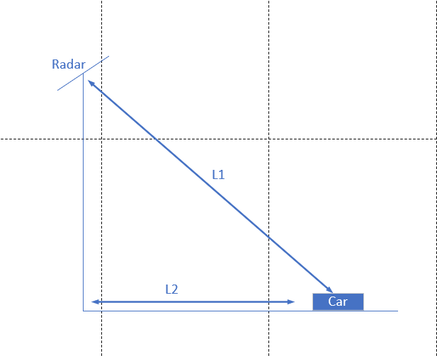
Hello, since IWR1642 is a 2D radar, it cannot detect the z-axis height of the vehicle, so I have a question. When it detects the vehicle at 7M, does the radar output the distance of L1 or L2?As shown in the figure below.If the radar output is the length of L1, I would like to ask whether the vehicle monitoring code written in Matlab code has processed the length of L1 output from the radar to make it the length of L2.

  • Former Member
    0 Former Member

    Hello if you are referring to the traffic monitoring demo, X,Y coordinates are given for the location of the tracked objects. So L2, L3 coordinates (unlabeled in your diagram). Range in radar is sensed as radial range measurement so L1. However in the demo users are asked to input the mounting height and tilt of the sensor so that the radial range can be mapped to an XY coordinate system.

  • Does the X-axis need to be corrected?

  • Former Member
    0 Former Member in reply to jh lan

    Hello,

    Please refer to the user's guide which shows that the elevation and azimuth tilt are taken as inputs to map the points onto a cartesian coordinate system where the origin is the sensor's location on the ground.

    Amanda