This thread has been locked.

If you have a related question, please click the "Ask a related question" button in the top right corner. The newly created question will be automatically linked to this question.

IWR6843AOP: gtrack's origin in people counting projects

Part Number: IWR6843AOP

Hi,

As see as in the Industrial Toolbox 4.4.1, there are people_couting and overhead_people_couting labs both of which need the sensor position and scene boundary configuration. Would you please help me check whether my following understanding is correct?

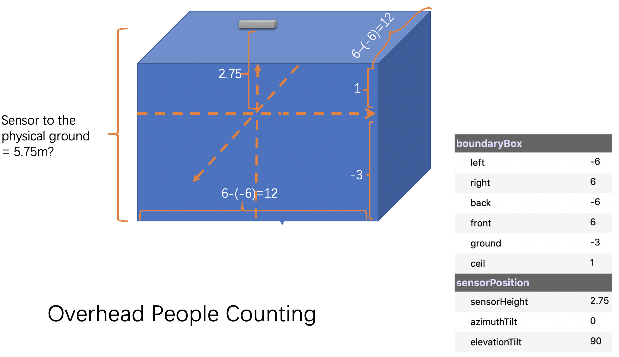
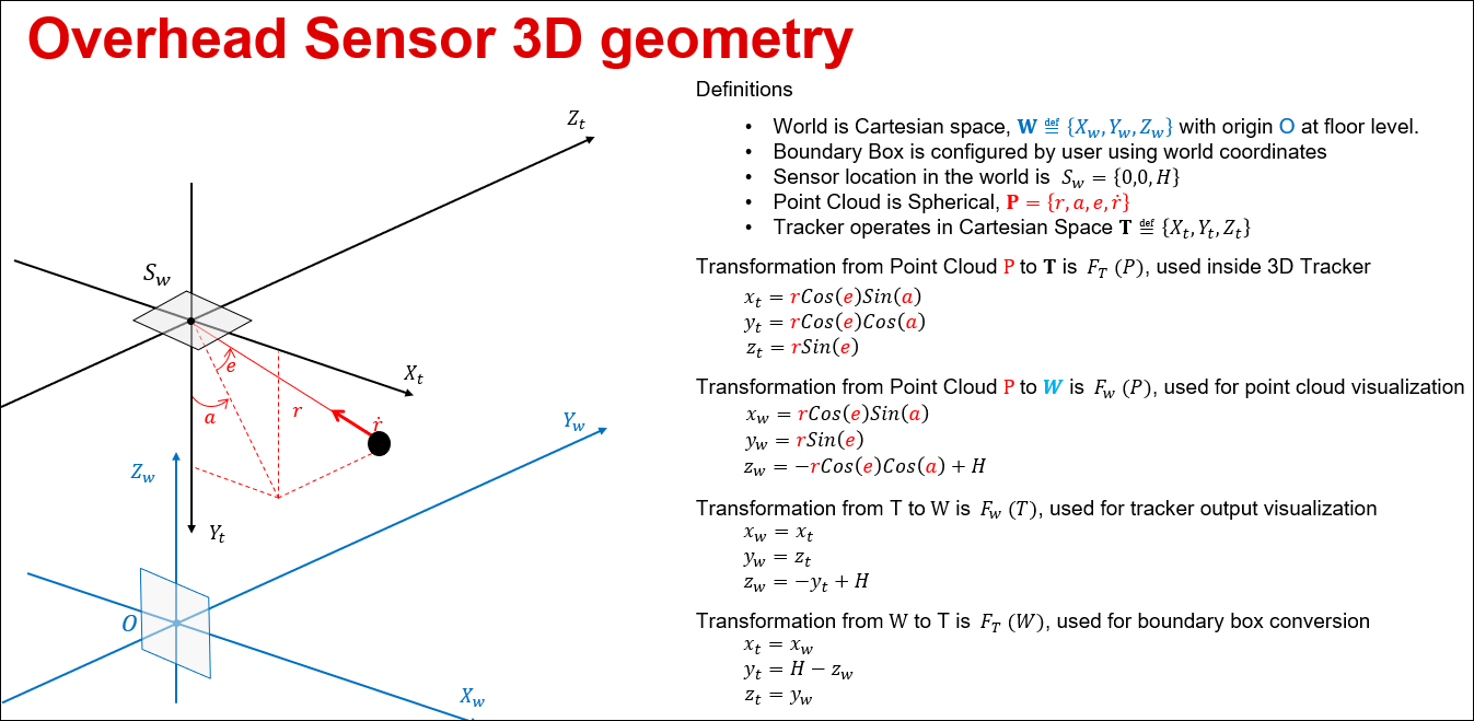
1. Origins used in gtrack are x=0, y=0 and z=-sensorHeight for both projects and the sensorHeight is actually the distance from the sensor to the origin. Is that correct?

2. The distance from the sensor mounting position to the physical ground is 2.75-(-3)=5.75 for both projects. Is that correct?

3. The translation from the boundary box's coordinate system to the sensor-centric coordinate system completely ignores the azimuthTilt of the sensor. Is it designed on purpose or just a simplified implementation?

Thanks,

Tom

  • Hello

    For  #1) output from device is relative  position to the sensor

    #2) This is the absolute height as mentioned in the UG.

    #3) Depends on the demo in use.

    Each of the above should be easily verifiable when you run the demo please let us know if you notice any discrepancy.

    Regards

    Vaibhav

  • Hi Haibhav,

    Yes, I did some tests and found it did not work as expected. So I illustrated the configuration in the following diagram

    I think the sensorHeight could be a relative value, otherwise the scene box especially the ceil will be higher than the sensor. Please correct me if my understanding in the above diagram is wrong.

    Cheers,

    Tom

  • Hi TI team,

    Do you guys have any suggestions about this?

    Cheers

    Tom

  • Hi Tom,

    1. Please look at the following picture which explains the co-ordinate transformations as used in the Ceiling mount demo. Please note that all co-ordinates in the configuration file are specified in the world co-ordinates i.e. how the user perceives them (in the room). The demo does the necessary transformations to map them to the sensor co-ordinates and back to world co-ordinates for visualization.

    2. Not sure I understand where the 2.75 is coming from. As noted the sensor height is specified using the Z value and it represents the height of the sensor from the floor.

    3. Azimuth tilt is not supported in gtrack and hence in the demo. It should not be used and may produce incorrect results.

    Regards

    -Nitin

  • Hi Nitin,

    Really grateful for your answer which is clear and thorough.

    I’ll check it against the configuration files provided in the lab projects and please allow us to take one or two days to verify this. Thanks in advance.

    Cheers,

    Tom